Japan’s Yonaguni Ruins May Hold the Key to a Sunken Civilization
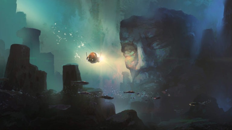
The mystery of the lost continent of Atlantis has puzzled researchers for centuries, as growing evidence supports the theory that an advanced civilization may have been destroyed and gone unnoticed by mainstream archeology. This antediluvian civilization is assumed to have been located somewhere in the Atlantic Ocean and is thought to have been the progenitor of ancient civilizations like those in Egypt and India. But could there have been another sunken continent from that era that predates Atlantis? The Yonaguni ruins might provide an answer.
The Yonaguni Monument
In 1985, a Japanese diver named Kihachiro Aratake was exploring the seafloor off the Southern shore of Yonaguni-Jima island, the Western-most island in the Ryukyu archipelago of Japan. Aratake came across what appeared to be the sunken ruins of an ancient, megalithic, stepped pyramid, similar to the ziggurats built in ancient Sumer. Since his discovery, the provenance of the ruins has been debated as to whether they are man-made or naturally occurring, due to the possibility of natural geological terracing.
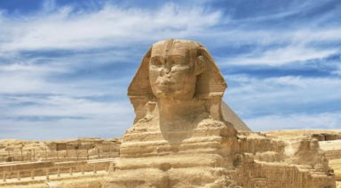
Dr. Masaaki Kimura from the University of Ryukyu is the biggest proponent for the theory supporting the artificiality of the ruins. Surprisingly, Dr. Robert Schoch is one archeologist who has contended Kimura’s theory, despite his support for the Sphinx water erosion hypothesis. Although, Schoch has conceded that he doesn’t perceive Yonaguni to be a closed case and that he hasn’t spent as much time diving there, compared to Kimura’s 15 years.
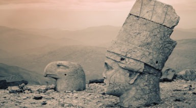
According to Kimura, the Yonaguni monument appears to depict carvings of animals and people as well as the remnants of a carved face, which he compares to the Moai heads on Easter Island. At the end of the last ice age, Yonaguni would have been connected to what is now mainland China. It is likely that the fate of the civilization that built the Yonaguni pyramid, was sealed by a massive tectonic event that triggered a tsunami and subsequent sea level rise.
Since the end of the last Ice Age, sea levels have risen some 40 meters, causing drastic changes in topography and lending credibility to the theory that there may have been cities or even continents that disappeared into the sea. Based on stalactite found in caves near the ruins, Kimura has calculated the Yonaguni pyramid to be at least 6,000 years old when it sank, with the potential to be up to 10,000 years old including the time prior to flooding. The oldest recorded flooding event at Yonaguni occurred in the late 1700s, during which a tsunami ravaged the island with 130 foot waves. This combination of sea level rise and catastrophic climatic events were likely the cause of this ancient city’s demise.

Courtesy of www.yonaguni.ws
An interesting discovery has been made when looking at the orientation of the angles in the Yonaguni ruins. One researcher believes that the radial lines, when extended out from the ruins, might potentially outline a territory in the Pacific. This theory employs geoglyphology, or the study of coded maps and messaging in ancient geoglyphs, and has drawn out the radial lines of the Yonaguni ruins. The Faram Research Foundation’s work shows lines that depict a map very similar to the territory sought after by Japan during WWII.
The area extends from Yonaguni and the South China Sea, up to the tip of Alaska’s archipelago, down to Hawaii and back over encompassing Indonesia and Burma (Myanmar). This territory, some believe, could be that which was occupied by the lost continent of Mu, a lost civilization larger and older than Atlantis.
The Lost Continent of Mu
The lost civilization of Mu, is thought to have spanned a large swath of the Pacific Ocean. Reaching from the Philippines Sea all the way to Easter Island, Mu would have encompassed most of the small islands in the mid-Pacific, including Guam, Fiji, Christmas Island, Midway and Hawaii. The conception of Mu was first proposed by Augustus LePlongeon in the 19th century who was the first explorer to photographically document the ancient Mayan city of Chichen Itza. It was there that he supposedly learned of the lost continent of Mu through his translation of the ancient Mayan Troano Codex.

LePlongeon’s translation showed that the Mayan civilization was aware of and predated the ancient Egyptian and Greek civilizations, while also mentioning another civilization that was lost in a cataclysmic event. But LePlongeon’s account is thought to be spurious due his use of a false translation of the ancient Mayan language.
But a later account of the ancient continent from a book published in 1926, by James Churchward, is thought to possibly carry more veracity. Churchward was an English occultist who spent several decades living and studying with a group of mystic priests in India. There he was shown esoteric tablets that detailed the erstwhile civilization and its supposed 64 million inhabitants called the Nacaal, who lived roughly 50,000 years ago. The tablets contained a multitude of vignettes, or a series of pictographs that supposedly told the story of Mu. In order to properly transcribe the vignettes, Churchward had to study an ancient language called Naga-Maya, known to only a handful of people in the world.
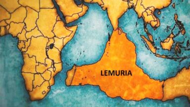
Although it is difficult to conceive of a continent this size to have just disappeared underwater, some believe that the Yonaguni monument may be a key to the explanation. Though Churchward’s translation didn’t garner as much notoriety as the search for Atlantis, some believe his interpretation of Mu to be one in the same with the lost city of Lemuria, popularized by Russian theosophist, Helena Blavatsky. Blavatsky’s depiction of the Lemurian people shares many similarities with Churchward’s account, that she also claims to have learned from an esoteric text given to her by Indian mahatmas.
Were Lemuria and Mu one in the same, or two disparate, ancient civilizations that fostered the mysteriously advanced ancient cultures we’re aware of today. While we have been obsessed with the search for Atlantis, it appears that there could be evidence of an older society that may hold clues to the knowledge of our ancient ancestors. Could the Yonaguni ruins be the key to uncovering these antediluvian people?
The Transformational Power of the Viking's Runes
The Birth of Runes
The Viking runes came into being when Odin brought them forth from another world. Historians from the National Museum of Denmark explain that Odin ruled over Asgard, which contains Valhalla, “the hall of the slain.” Half the warriors who died in battle were collected by his female handmaidens, the valkyries, who belonged to him. As such, Odin was the object of worship by kings, warrior chieftains, and their people.
In a mythic Viking tale, Odin wounds himself with his own spear before hanging himself from the Yggdrasil—the world tree in Norse culture—for nine nights, drawing wisdom from the Depths of Urd, just below it. From there, Odin sees the runes that existed even before his own coming into being, “a time before time.”
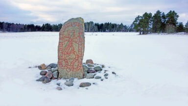
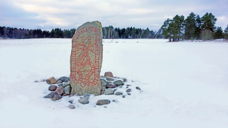
Just as he’s about to die, Odin gathers up the runes and shares them with all of creation and an array of supernatural entities and human beings. Eventually, the runes were given their shapes and phonetic values by subsequent tribal elders. They were carved on weapons, tools, jewelry, amulets, bones, pieces of wood, memorial stones, church walls, and other hard surfaces.
Ancient peoples of the Germanic lands knew the runes to be beyond the time and space with which most people are familiar. Some experts suggest that they were never really “invented,” but are instead eternal, pre-existent forces that Odin discovered through his aforementioned superhuman ordeal.
Historians have linked the runes to areas with a history of Germanic-speaking peoples, including from Iceland to Scandinavia, throughout England, and into Central Europe. Even Constantinople is home to the runes, showing that ancient seafaring cultures had made their way into what is now modern-day Turkey.
Reading the Runes
We may use the metaphor of a tree to assess how the runes are read. Historian Emma Groeneveld noted that “they are generally made up of vertical lines — one or more — with ‘branches’ or ‘twigs’ jutting out diagonally (and very occasionally horizontally) upwards, downwards or in a curve from them. They can be written both from left to right and from right to left, with asymmetrical characters being flipped depending on the direction of writing.
Each rune represents a phoneme (a speech sound) and had a name, made up of a noun, that started (and in one case, ended) with the sound the rune was mainly associated with. Lots of regional and temporal variation existed in the shapes of the letters.”
Experts of Norse mythology explain that, on the surface, runes seem to be letters. However, they are much more, because each one is a symbol of a cosmological principle or power. The very act of writing a rune called upon unseen spiritual forces. In every Germanic language, wrote historian Daniel McCoy, the word rune comes from the Proto-Germanic word that means both “letter” and “mystery.”
The Eternal Magic of the Runes
The runes have been used to link the natural and supernatural worlds, and this gives them the power to enact spells for protection or success. Still, said Olsen in an exclusive Gaia interview, according to archaeological and historical evidence, runes were used as magical tools for healing, transformation, building wealth, and for making the world a better place.
The power of the runes is in their sound vibrations, teaches Olsen. Each runic character represents a letter so that it can be combined with others to form words. The runes are also magical symbols, and each character has its own name and symbolic meaning.
Norwegian historian Marit Synnøve Vea explained that runes are not limited to their carved signs, but are also applied in certain songs, magical formulas, secret skills, and for secrets hidden in Skaldic (Old Norse) poetry. Vea noted that runic magic was used to foretell the future, as a form of protection, to cast spells, to cure illness, to bestow love, and much more.
But where there is power, there is a warning. In the wrong hands and minds, runes carved by unskilled persons could represent risky business. Vea cites a poem from the Old Norse Egil Saga that serves as an ancient warning for the modern generation:
Runes none should grave ever
Who knows not to read them;
Of dark spell full many
The meaning may miss.
Ten spell-words writ wrongly
On whale-bone were graven:
Whence to leek-tending maiden,
Long sorrow and pain
The history of the runes is the history of timelessness, a paradox among paradoxes. Often regarded as tools for parlor games, serious historians have found the deeper meaning in ways the runes can be read and applied for the betterment of life on this planet and the invisible worlds.


