Mysteries of the Grand Canyon: Pyramids and Ancient Civilizations

Below the Utah/New Mexico border, running along the Western edge of sprawling Navajo, Havasupai, and Hualapai reservations lands, the Colorado River has patiently carved a geological masterpiece — the Grand Canyon. Despite the extreme desert climate, native people have inhabited the region for centuries.
Dominating the landscape beyond the Rocky Mountains, the immense Colorado Plateau stretches 130,000 square miles from the Wyoming border to the North, the Arizona/Nevada border to the East, and beyond the Four Corners region along the Colorado/New Mexico border further East.
A thorough exploration of the region would take months — even years. The Grand Canyon alone could take weeks to explore, beyond requisite tourist attractions. The Havasupai people have lived in the canyon for at least 800-years, and have successfully fought for restoration of tribal lands taken by the federal government. A travertine dome near the confluence of the Colorado and Little Colorado rivers is believed to be the “sipapu,” or “place of emergence” by native people. This sacred formation is nameless, simply referred to as sipapu by indigenous people. Tribal leaders prefer to keep the location private.”
“Few locations on the planet can rival this amazing ‘great wound in the Earth,’ as it was described to Francisco Vasquez de Coronado by the Hopi in 1540,” said Christopher O’Brien, a journalist and investigator who has explored the canyon and its legends for years.
The first documented white man to “lay sight” on the confluence area in Marble Canyon was Seth Tanner, a Mormon pioneer married to a Hopi woman. While he had good relations with the Navajo and Hopi tribes in the region, when the Hopi learned he had seen the sacred site, they blinded him. His life was spared because of his Hopi wife, but he was told that if he spoke of what he saw, his tongue would be cut out.
Then there’s the astonishing geology — hoodoos, towering mesas, land bridges, and ancient “Vishnu” schist, the basement rock found on the canyon floor, 1.8 billion years old. But this isn’t the only example of geologic features with names from myth and exotic pantheons — there are also Brahma and Rama schists, Babylon Cave, Isis Temple, and the “Cheops” pyramid — a natural pyramid formed by long, slow erosion. Other pyramid formations bear names like “Apollo’s Temple,” “Buddha Cloister,” or the “Tabernacle.”
While some speculate that these commanding geologic formations were engineered by something other than nature, there is simply no indisputable proof. One theory is that these monoliths were built by an ancient civilization and over time, were buried in sediment. The Colorado River eventually washed away the sediment, revealing the ancient formations.

Evidence of an Ancient Civilization in the Grand Canyon?
G.E. Kincaid, born in 1863 in the then-wilds of Idaho, was a hunter, explorer, and erstwhile archaeologist. For thirty years he had explored the West for the then-young Smithsonian Institute under Prof. S.A. Jordan, ostensibly employed by the institute. In 1909 he embarked on a journey down the Colorado River in 1909 in a wooden skiff — a less than ideal boat for navigating the river.
Starting from the Green River in Wyoming, Kincaid traveled down the Colorado “looking for mineral” like others exploring for gold in the main canyon and secondary tributaries such as the Little Colorado Canyon. He described when reaching Marble Canyon near the confluence of the Colorado and Little Colorado Rivers in 1908, an area where there were “stains in the sedimentary formation” roughly 2,000 feet above the riverbed. Geographers estimate that Kincaid was at about mile 56 of the river.
Treasure Cave?
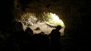
Somehow Kincaid scaled the 2000 ft. with “great difficulty,” hauling his camera and glass plates with him. According to the April 9, 1909 Arizona Gazette, Kincaid discovered a cave entrance — upon entering, he discovered what was called “The most important archaeological find in North America.” Called an “underground citadel,” the cave was reportedly vast, with hundreds of chambers filled with mummies and artifacts that appeared to be Egyptian.

Arizona Gazette report of Kincaid’s discovery.
He described a “cross hall” with a buddha-like idol sitting cross-legged with a flower in each hand, carved out of the chamber walls. Additionally, Kincaid reported “vases or urns of copper and gold, enamelled and glazed vessels, granaries filled with seed, burial chambers filled with sarcophagi, and countless other wonders.
According to the story, Kincaid left the location and arrived in Yuma, AZ. Shortly after, the story was published in the Arizona Gazette. There are rumors of the Smithsonian sending a team of 30 to explore and document the amazing find — but no evidence remains. Shortly after, news stories regarding the discovery evaporated into silence.
When queried later, Smithsonian officials denied institutional relationships with Kincaid or Prof. S.A. Jordan. The site and its surroundings in Marble Canyon were reportedly acquired by the U.S. Government and declared “off limits” to visitors. A metaphorical door slammed on the entire topic.
But stories have persisted, and many claim to know the location of the entrance, called “Kincaid’s Door.” Theories and speculation about a coverup abound; just do a google search on “Grand Canyon Egyptian Artifacts,” or some variation — a search will return pages with assertions that the story is a hoax, that the story is true and that the cave was claimed by a secret society, or that the cave is home to reptilian humanoids as per David Icke. To explore the story, start with a segment of Regina Meredith’s “Open Minds” on Gaia — guest Jerry Wills shares details of Kincaid’s Grand Canyon discoveries.
This Hindu Prophecy is Eerily Similar to Nostradamus' Predictions

The Kalki Avatar Prophecy states that Vishnu will appear in his 10th form to end the Kali Yuga, Nostradamus predicted a similar event.
According to the Hindu Yugas, we are currently living in the Kali Yuga – the Iron Age, Dark Age, or the lowest point in spiritual consciousness and moral virtue. Despite technological advancement, our current age has been marked by war, inequality, and scarcity. And though this may be a subjective observation, there are certainly some aspects that carry some validity.
While the start and end dates of the Kali Yuga are disputed and somewhat ambiguous, many believe we are nearing the end, when Kalki, the final avatar of Vishnu, is supposed to make his messianic return to Earth. This return will usher in the Satya Yuga, our upward journey back to the pinnacle of truth and cosmic order, known as dharma. Many believe we are on the precipice of experiencing the return of this enlightened being and there is even evidence that Nostradamus’s predictions corroborate this Hindu prophecy.

