Teotihuacán: City of the Gods or Ancient Spaceport?
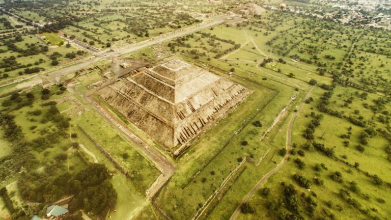
The time: The first century. The place: Teotihuacán, one of the largest Mayan cities in ancient Mexico. Its name means “City of the Gods,” or “the place where men become gods.” Despite the ancient time period, the civilization was a bustling metropolis, housing sophisticated infrastructure, engineering, and technology.
Suddenly, the residents of the great city disappeared in 7 A.D., leaving behind their once-thriving civilization. Where did they go, and why? No one is entirely sure of what happened, but a few key pieces of evidence tell us that the residents of Teotihuacán were more advanced than once thought.
Both mica and mercury — minerals that play an integral role in today’s aerospace industry — have been discovered in Teotihuacán’s ruins. Is it possible that the city’s residents departed their beloved city to establish breakaway civilizations elsewhere?
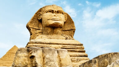
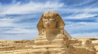
Other questions arise concerning the ruins that were left behind. The Teotihuacán pyramids turn out to be very similar to the ancient pyramids found in Egypt. How and why did that happen? The Mayans left behind mysteries that scientists, archeologists, historians, and interested people are still trying to unravel even after all these years.
Teotihuacán: Ancient History and Geography
The ruins of Teotihuacán, one of the largest cities in the ancient world, lie about 50 km (31 miles) Northeast of Mexico City. It’s believed that the city was established in 1 B.C. By the year 2 A.D., it was a thriving metropolis with a population of about 150,000 to 200,000 residents. It was given its name by the Aztecs who made pilgrimages to the ruins in later years.
The ruins reveal scores of apartment buildings, most with flat roofs that support the theory of rooftop gardens or terraces. Other structures that appear to be residences are small buildings clustered around a central courtyard. In the center of the courtyard is a kitchen where the community residents possibly gathered for their daily meals.
The city established an irrigation system to take advantage of its plentiful supply of spring water. Adequate water, good soil and a moderate climate contributed to its flourishing vegetables and fruits, including corn, tomatoes, beans, avocados and cacao, the latter of which they used for its many health benefits. There was ample wild game to round out their diet.
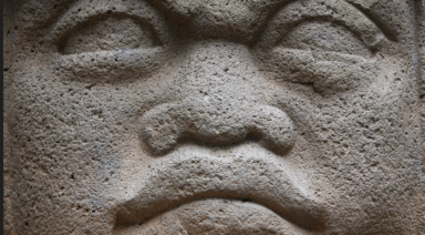
Teotihuacán citizens had a penchant for arts and crafts. Archeologists uncovered sculptures and pottery including round dishes three feet wide and a lid, decorated vases, incense burners, and figurines. They have also discovered clay and stone masks that apparently adorned statues. Most of the buildings were decorated with murals ranging from simple landscapes and fountains to detailed portrayals of religious events.
In addition to ample water, Teotihuacán also had a river of mercury running underneath it. Large quantities of the mineral mica have been found in almost all of the buildings in the city — a mineral that’s known today for its many uses in the electronics and aerospace industries.
Testing shows the mica found in Teotihuacán originated from Brazil, more than 2,000 miles away. Today, there is still no explanation for how the Mayans transported the mica or why they needed it in the first place. Today, mica is used as a capacitor in construction, as well as for thermal and electric insulation. It “acts as a moderator in nuclear reactions” and is thermally stable up to 500 degrees Celsius.
In addition, archeologists found evidence that the city had a “flourishing road system, working plumbing and running water.” Were the Teotihuacán residents advanced enough to have access to other technology such as spacecraft?
Teotihuacán: Ancient Spaceport?
The architectural layout of Teotihuacán indicates that it would have been perfect for an ancient spaceport. It is 20 square kilometers (12 sq. miles) and has a “precise grid layout.”
The dominant feature of the city is its wide Avenue of the Dead, which begins in the agricultural fields and runs through the entire length of the city, ending at the Pyramid of the Moon. The avenue today measures almost 3.2 kilometers long (2 miles) and 40 meters (131 feet) wide. Archeologists have discovered that the avenue was actually a lot longer and wider than it appears today.
Satellite photography strongly suggests the Mayans designed this avenue to be an ancient airport or spaceport. The remains of some of the buildings along the possible runway indicate they were used to support aircraft. After examination, scientists discovered landmarks along the runway: these landmarks appear to have been designed for the pilots to see in order to inform them about any instrument changes they needed to make.
Pyramids of Teotihuacán and Giza
Two great pyramids dominate the Teotihuacán landscape with a smaller one nearby:
- The Pyramid of the Sun at one end of the Avenue of the Dead
- The nearby Pyramid of the Moon
- The Temple of Quetzalcoatl Archeologists discovered that their “size, layout and particularly their positions relative to each other almost exactly match those of the three pyramids at Giza in Egypt.”
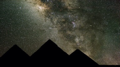
The three Teotihuacán pyramids and the Giza pyramids are all “in the same layout as the stars in Orion’s belt.” Even more staggering is that the engineers who were in charge of building the pyramids at both locations demonstrated a “[fundamental understanding of the mathematical constants π, Φ, and e.
Ancient Sound Technology; The Breath of Creation

Crashing waves. The thump of a palm against a taut drum skin. The wail of a new born baby. Sound is our tether to the present, to one another, and to our deep and ancient sense of the world. Throughout the ages, ancient sound technology, created through voice, instruments, and the natural world has provided healing and spiritual connection.
Every ancient civilization is based on the belief of the sanctity that is sound, from the Old Testament’s verse, “and God said, let there be light,” to the meditative Aum of the Hindu tradition; sound represents a spiritual significance that is essential to the human relationship to nature, self, and one another.
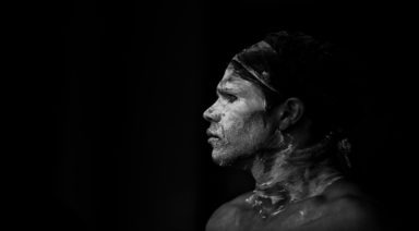
The first ancient people known to use sound as a healing power are the indigenous people of Northern Australia. The ancient culture created a kind of sound healing expressed through the didgeridoo, or its ancient name, the yidaki. Made from fallen eucalyptus branches hollowed out by termites, the didgeridoo is considered to be the oldest wind instrument, dating back more than 40,000 years.
Used in ceremonial rituals and for its healing properties, the didgeridoo was also a way to communicate across far distances due to the unique sound waves which are believed to be able to be heard through the Earth. The low frequencies produced by the didgeridoo are thought to heal, help with mobility, and open up energetic flows.
“He who knows the secret of the sound knows the mystery of the whole universe” – Hazrat Inayat Khan
North American indigenous cultures incorporated “reciprocal participation” in their tribal ceremonies with a complex and interconnected musical exchange that ranged across nations and tribes. Used for ritualistic purposes, creative expression, and healing, making and sharing music has always been central to Native American daily life.
According to the American Indian Heritage Foundation (AIHF), “ [u]nusual, irregular rhythms and a somewhat off-key style of singing are used. No harmony is ever incorporated, although sometimes many people sing at once, and other times the vocals are solo. The Native American vocals are passionate, used to invoke spirits, ask for rain or healing, or are used to heal the sick.”
AIHF states that “many researchers feel that Native American music is some of the most complex ever performed. The tensing and releasing of the vocals combined with varying drum beats make it a very intricate form of art.
In ancient Egypt, seven vowels served as sacred sounds, creating a strong euphony, or harmonic convergence. In addition to the human voice, Egyptian high priestesses played the sistrum in ceremonies, a kind of rattle with metal discs attached to it that generated an “ultrasound” to enhance healing, and which is still in use today. The ancient Egyptians believed so strongly in the power and sanctity of sound that there are no vowels present in their written language of hieroglyphics.

